#201 - 5760 Teredo St
Sechelt, BC V0N 3A0
Canada
Sechelt, BC V0N 3A0
Canada
|
#201 - 5760 Teredo St
Sechelt, BC V0N 3A0 Canada |
|
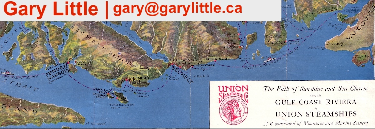
Sunshine Coast Waterfall MapThe map below shows the locations of interesting waterfalls in the Sunshine Coast area of British Columbia. Take a look at these other interactive maps created by Gary Little: |